The weather gods obviously read my blog. Today, we had 12 °C during the day and enough rain to give the allotment a good soaking. That was fine but…. If it is OK with you guys could we order day time temperatures in the 20 to 22 °C region (with fluffy white clouds and a gentle breeze) and a bit of rain sometime between midnight and five in the morning.
Like most households in the UK, we have discovered that we have too much stuff. Like a lot of people we have spent some of our time in lock-down sorting through that stuff, and discovering that we don’t actually need a lot of it. The problem is that during lock-down, most of the outlets for excess stuff, charity shops, Freecycle, and the tip are closed. We were very pleased when Diane’s son Ben announced that he was getting a skip, and that if there was any room left over we could use it. We loaded the car up and set off over there after lunch. Diane made fairy cakes to say thank you.
After supper (stir-fry) we watched a rather strange film.
We joined the Black Lives Matter protest in New Malden this lunch-time. I was fairly low key event compared with the protests yesterday in London. The organisers asked us to keep two metres apart and to wear masks. The physical distancing and the mask wearing wasn’t perfect, but it was better than normally experienced in Lidl or Waitrose. The event was noisy, but passed off peacefully. The police drove up and down the High St in their BMW i3 (a nod to eco-responsibility) a couple of times, then disappeared, presumably bored, so back to the station for a cup of tea.
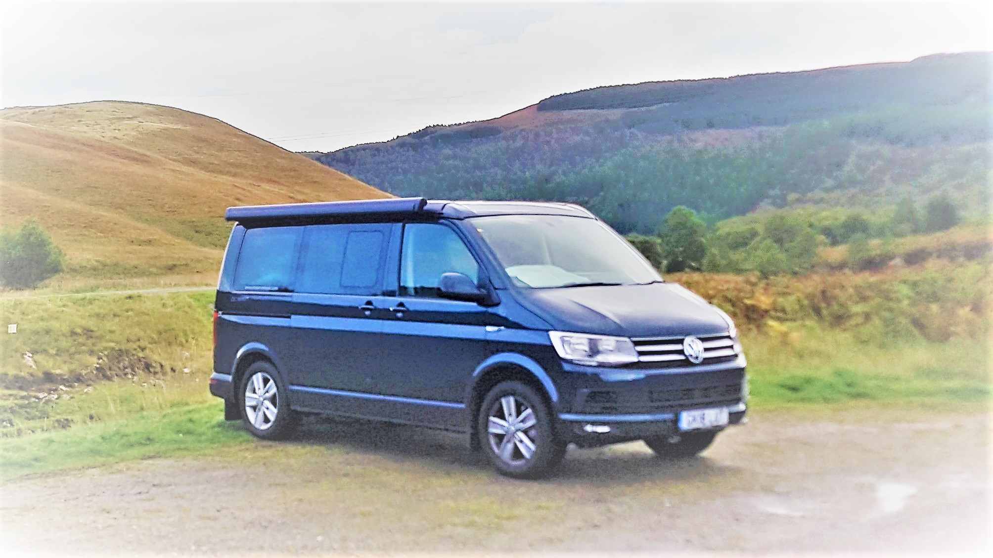
We now only have the one campervan. Diane’s Bongo went off to it’s new home this afternoon. It was a bit sad, but we don’t really need a campervan each. Still as she explained to the woman who bought it, “How was I supposed to know that six months after buying it I would meet a bloke with his own bigger and newer campervan?”.
Today was the day when I had to head south with a purpose.
Day 1 to An Gearisdan (Fort William)
There is no direct road due south (unless you want to walk) so I set off in the direction of Loch Maree and Torridon.
Loch Maree
The weather was a bit overcast and drizzly, which made heading home a little bit easier. It also meant that the photographs were a bit on the grey side.
As I arrived into Torridon (an area where mobile phone signals exist) I received a text from my bike shop telling me that my Brompton (which should have been there in plenty of time for my trip) had finally arrived, and would I like to come and collect it. If I had had the bike it would have enhanced my trip, but I couldn’t really say that not having it spoiled my trip. It meant that I went for a walk where I would have gone for a ride.
Torridon
Torridon
Torridon
From Torridon the Starlight Express and I headed on along the southern shore of Loch Torridon until we reached Sheildaig where a decision had to be made. The coastal route via Applecross and the Bealach na Bá (Pass of the Cattle) is supposed to be spectacular. It is also on a narrow single track road which climbs to a height of around five hundred and fifty metres with hairpin bends and a few unguarded drop offs. The cloud base was about three hundred metres so I would be driving the trickiest bit of the road in the clouds with next to no visibility. So, no views and the chance of accidentally driving of the edge of a cliff; I chickened out and decided to take the valley road. Next time if the weather is clear we will take it.
The valley road to Lochcarron was attractive enough though.
I stopped in Lochcarron for lunch at the Waterside Cafe. Like all the places I ate at during my trip it did simple things really well. Excellent soup and a sandwich to go with it.
Moving on after lunch I didn’t get very far. There were major road works on the other side of the loch. I think there had been a landslip. This necessitated a convoy system, which was complicated by the fact that the road was diverted onto the railway for about a quarter of a mile. Naturally the trains had priority.
So there I was, stuck. Anyhow as I said earlier, in a camper van you can always make a pot of coffee whenever you feel like it. So I decided to do that. As Sod’s law dictates, just as the coffee pot came to the boil the traffic decided to start moving. I manged to pour it into my travel mug while ignoring the toots from the cars behind me and set off with a mug of good coffee to keep me going.
The Starlight Express, or at least her sat-nav was making a case for diverting through the Isle of Skye. It would have been less distance, but any time saved would have been dependent on the ferry to Mallaig being exactly synchronised with my schedule. I decided to stick to the mainland route.
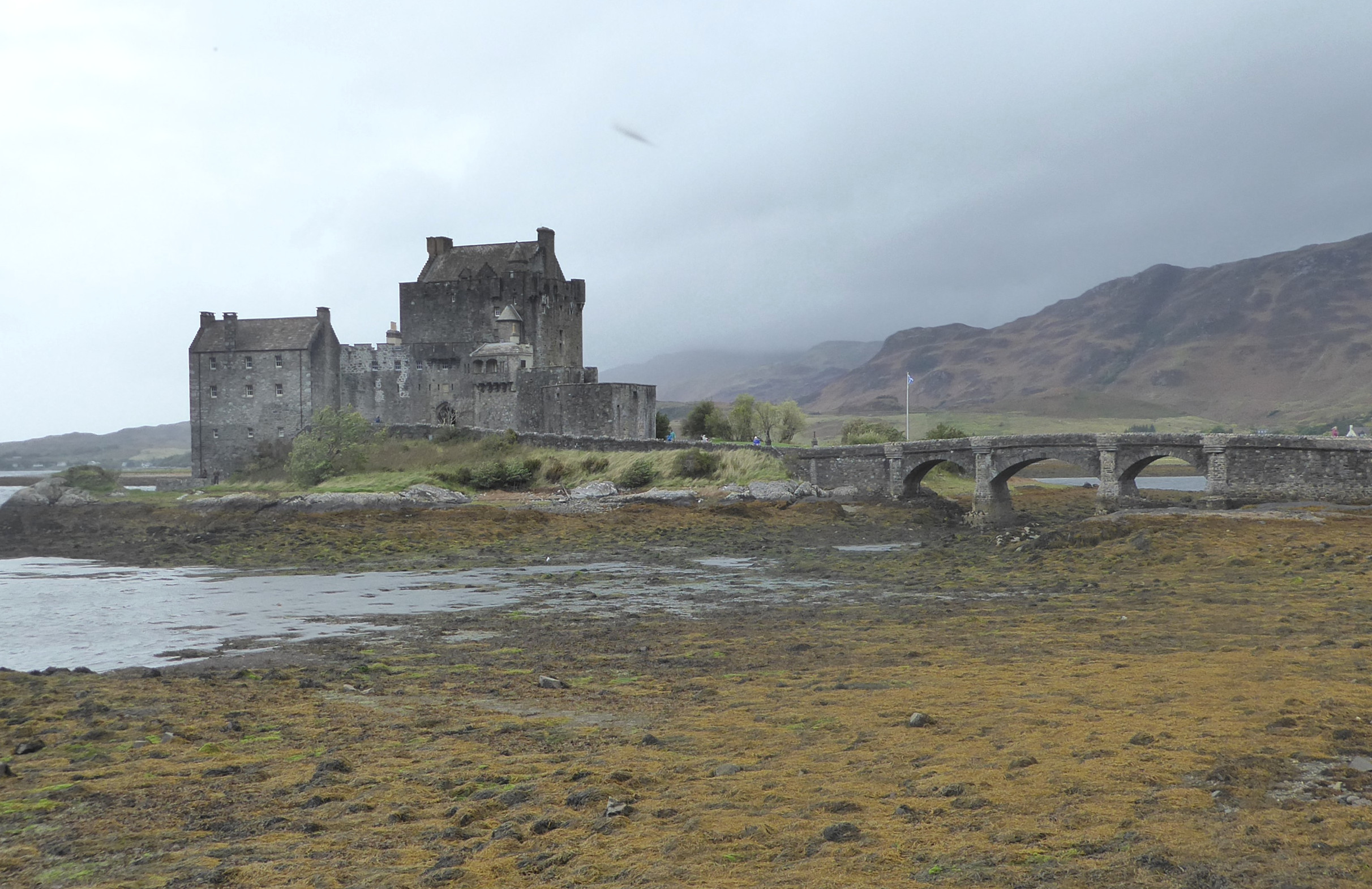
A few miles further on I stumbled across something that I wasn’t expecting; Eilean Donan Castle. I must admit that I didn’t really know exactly where it was. But having found it I thought it would have been rude not to stop and take a few photographs at least. (Besides I did need to go to the toilet)
Eilean Donan Castle
I don’t know very much about the history of the castle beyond the fact that it is a compulsory stop for every coach tour of the Highlands. but a click on the link will take you to an informative Wikipedia page. Feeling suitably relieved I pressed on to Fort William.
The weather was beginning to deteriorate and by the time I arrived at the foot of Ben Nevis it was blowing a full gale with horizontal rain.
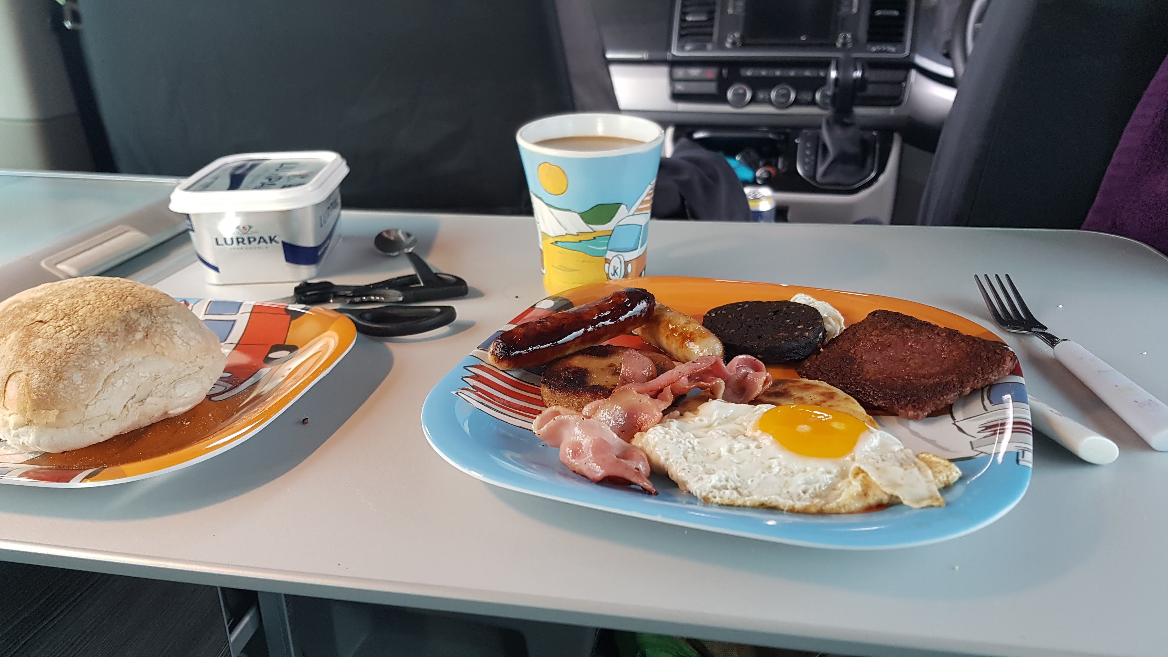
There is supposed to be a good pub/restaurant about ten minutes walk from the campsite I was staying at, but I whether it is or not I still don’t know. I didn’t fancy arriving there looking and feeling like a drowned rat so I decided that it was a night for cooking in the van. Some pasta in a tomato and basil sauce washed down with a chilled red (the only place I could find to keep a half full bottle of wine upright was in the fridge) did the trick.
I also found a travelling companion today, Kylie the Campervan Coo.
Day 2 Back to England
The following day dawned grey, but not quite as wet and miserable as the night before. “Dreich” summed it up. The plan was to get as far south as I could, while remembering that I was still on holiday. The route more or less planned itself. Down Loch Linnie to Ballachulish, through Glencoe to Crianlarich, then down Loch Lomond to Glasgow where I would pick up the M74 for the dash south. Kylie thought the plan was OK as well, or at least she didn’t object.
The grey, dull misty weather didn’t make for great driving conditions, but It did lead to some very evocative photos, especially of Glencoe.
I didn’t have the time, and given the weather, the inclination, to do more than take a few photographs. Glencoe is a place of spectacular scenery and not a little history. The Glencoe massacre of 1692 is infamous.
Onwards and southwards, The Starlight Express, Kylie and I went, passing through Bridge of Orchy, Tyndrum and Crianlarich before arriving “By Yon Bonnie Banks” in time for morning coffee. The weather was still pretty miserable but the sun was making a vague attempt to find its way through the clouds.
Loch Lomond spat me out into the outskirts of Glasgow and traffic and dual-carriageway roads. Things that I had forgotten about in the last week or so. I coped, managed to find my way over the Erskine Bridge, onto the motorway network and eventually onto the M74 south. I stopped for lunch at a service station somewhere south of Glasgow and north of the border.
I also managed to find a bottle of raspberry wine for my friend Toby. We have a competition to see who can bring the most horrible local hooch back from holiday. There was no way that it was going to be as vile as the coffee flavoured ouzo that he brought me back from Greece. The important thing is the taking part not the winning. (It did turn out to be reasonably vile though, probably more strange than actually undrinkable.)
I crossed the border near Gretna Green. I was trying to work out how far south I could get before dark (it is easier to set the van up if it is daylight). Google said there was a campsite at Kendal, not far off the motorway, so I decided to stop there for the night.
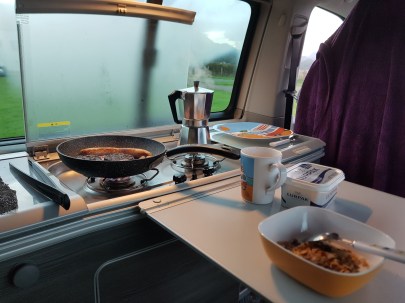
I went for a walk into town to find something for dinner, but the only pub I found didn’t do food. I wandered back to the van. It was actually quite nice to cook one final dinner in the van.
Final dinner
Day 3 Home again
There isn’t that much to say about today. The Starlight Express’ Sat-Nav gave me a pleasant little tour around the foothills of the Cumbrian Fells because it thought that there was some kind of a hold up on the motorway. It eventually led me back on to the M6 somewhere around Morecombe and after that it was dive down the motorway to home. I stopped somewhere along the way for lunch and made one last pot of coffee.
I arrived home mid afternoon and I must admit the Starlight Express looked at home on the drive.
Day 4 Saying goodbye
I had to return the Starlight Express by ten o’clock, so I was up reasonably early and about nine I reluctantly set off for Forrest Hill to return her to Campervantastic. They asked me how the trip had gone, so I told them; “I enjoyed it so much that you may have lost a customer”
I reluctantly decided that today was the day when I had best start to work my way south towards home. I wasn’t really all that sure how far south that I wanted to get. I think I had plans to get as far south as Fort William ( or An Gearasdan as it is shown on the bi-lingual road signs).
A slight diversion. Road signs in Scotland now are generally bi-lingual. In the Gàidhealtachd the Gaelic name is given first, but as you move south into the English (or more properly Scottish speaking areas the English version is shown first.
Bi-lingual Road sign
I got as far as Gairloch, which is about 30 miles further south, but because it is quite a bit further west, I’m not sure that it was much closer to home.
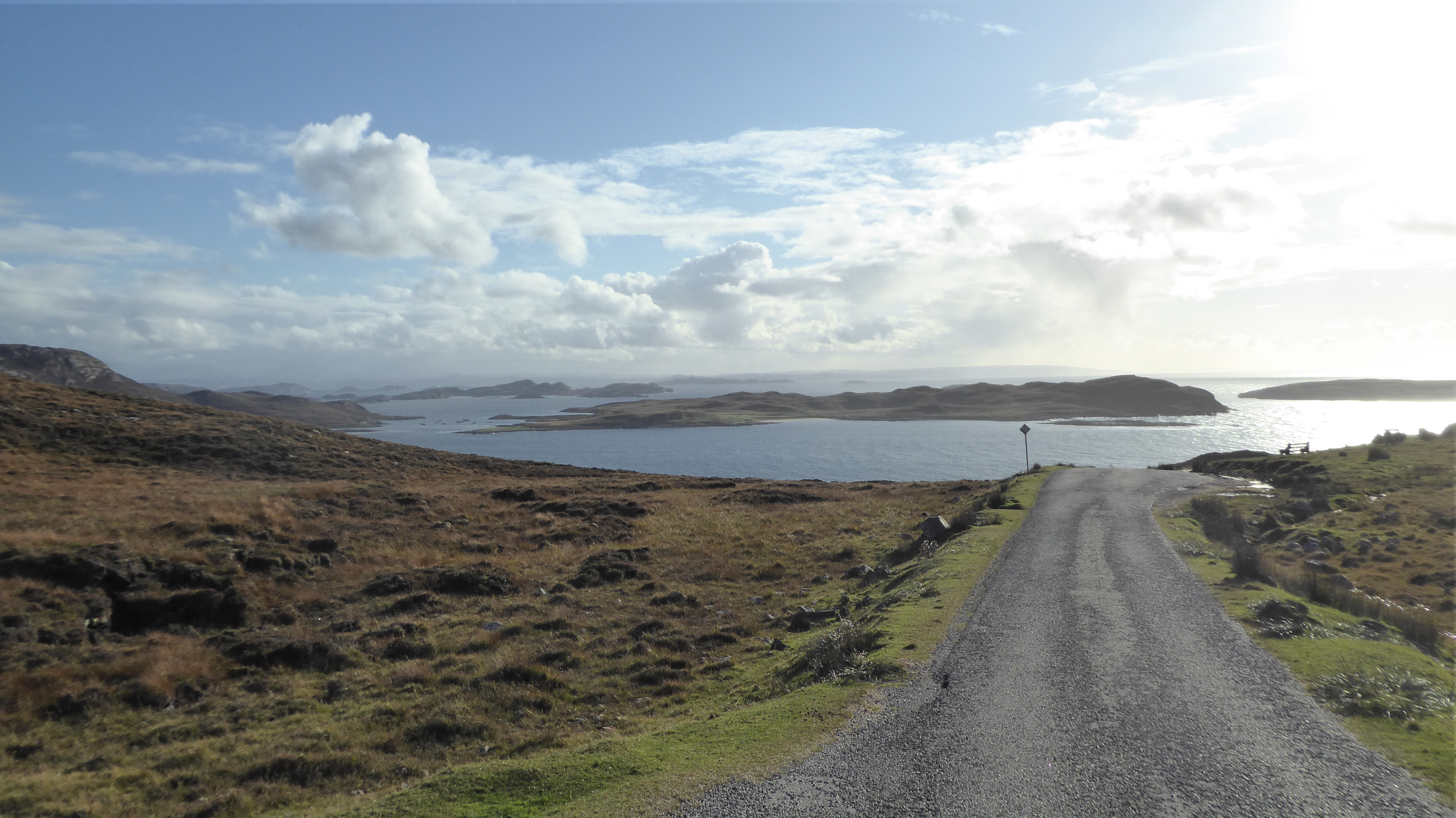
Altandhu is out on a limb, so I had to retrace a bit of yesterday’s route before picking up the main road south to Ullapool. It wasn’t too much of a hardship, the scenery is spectacular which ever direction you look at it.
I thought about stopping for a coffee in Ullapool, but didn’t for two reasons. I was slightly bothered, given my tendency to be distracted, that I would end up on the ferry to Stornoway and a tour of the Outer Hebrides. Also when you are in a Campervan with a stove top espresso maker you can stop and make a coffee where and whenever you feel like it.
As I was driving down the east shore of Loch Broom I did become distracted by a ferry, or to be more exact the memory of a ferry. About thirty-five or possibly forty years ago I did a walking/hitch-hiking/public transport tour of the Highlands. I remembered taking a foot ferry across Loch Broom from Ullapool then walking over the peninsula between Loch Broom and Little Loch Broom. I then more or less followed the coast round for a few days until I eventually ended up in Torridon. I thought it might be an idea to try to replicate the journey. I knew I wouldn’t be able to do all of it as there was one section from Redpoint to Diabaig that could only be done on foot or Mountain Bike. So instead of carrying on south I turned right at Braemore onto The Destitution Road.
The road climbs over the moors, with An Teallach dominating the horizon, before dropping back down to Little Loch Broom at Dundonell, where I stopped for lunch. Moving on down Little Loch Broom as well as the obvious spectacular scenery you come to a place called Gruinard and about a kilometer off the coast an island called Gruinard Island, which has an interesting, slightly sinister, history. The last time I was here there were notices up all along the shore warning you not to attempt to land on the island. During the Second World War it had been used for experiments in biological warfare and the soil was still contaminated with anthrax. It has since been decontaminated and returned to its original owners.
I carried on following the coast road until I reached the village of Poolewe. Poolewe is the home to a rather remarkable garden. Because of the effects of the Gulf Stream, a benign micro-climate allows plants to be grown on the north-west coast of Scotland that you might not think possible. (Plockton, for example, is famous for its palm trees). Inverewe Gardens were created in 1862 by Osgood MacKenzie and later after his death, his wife and daughter further developed them. His daughter gave the gardens to the National Trust for Scotland shortly before her death.
I had brought my National Trust membership card with me, and as it gave me free entry to the gardens I thought I might as well. I’m glad that I did. In late September, when I visited, the gardens were past their best, but still worthwhile seeing. I would guess that they are at their most spectacular in late spring when the Rhododendrons are in full flower. It is easier to post pictures than try to describe in words, so here are (some of) my photographs.
This slideshow requires JavaScript.
After my walk around the gardens, and buying a T-shirt from the gift shop, I decided that it was time to find somewhere for the night. It was nearly five o’clock and as the saying goes, “the nights were fair drawing in”. I decided to drive across to Gairloch rather than spend the night in Poolewe. It was on the way to Fort William (remember, where I was heading when I set out this morning) anyway.
The skies were distinctly grey as I set off, but the weather forecast was hopeful. By the time I stopped to make a coffee at Oykel Bridge the sun had come out.
Starlight Express at Oykel Bridge
After my coffee break I carried on, heading north-west into the wilds of Assynt and Wester Ross. As I travelled west the scenery became more mountainous and spectacular. Passing through the village of Inchnadamph at the south end of Loch Assynt this was the view that greeted me.
Ardvreck Castle and Quinag
The ruins were once Ardvreck Castle a stronghold of Clan MacLeod, who once held sway over the lands of Assynt. The original keep dates from around 1490. The mountain behind the castle is Quinag.
I carried on along the north shore of Loch Assynt, heading for Lochinver. The clouds, mountains and sun combined with a stiff breeze to create a constantly changing sky scape.
Lochinver is one of the biggest villages in this part of the world. It is also one of the biggest fishing ports in Scotland. Because of its sheltered position at the top of Loch Inver it has always been an important port for landing fish. In the 1990’s the port area was extensively redeveloped.
One of the companies that transports the fish from Lochinver to its destination has some interesting looking trucks. The combination of Christian and Celtic imagery on the left hand trailer was particularly noticeable.
Interesting combination of Celtic and Christian imagary
One other thing that struck me as I was wandering around Lochinver was the names on the War Memorial. It wasn’t quite so much the names (there were a lot of MacKenzies and MacLeods both Assynt names) as the regiments. Roughly a fifth of the Assynt men killed in World War 1 belonged to Canadian regiments. There must have been a major emigration in the years leading up to the war.
I traveled on from Lochinver over a wonderful, narrow, twisty single track road to Altandhu and the Port a Bhaigh Campsite. That part of Assynt is dominated by the peaks of Suilven and Cansip.
The view from the top of the ridge above Altandhu is spectacular.
The Port a Baigh campsite was probably my favourite site of all the sites that I stayed at. The views were great, the facilities were modern and clean and across the road was a bar cum restaurant called the Am Fuaran (The Well) Bar which did great locally sourced food at a reasonable price. By the time I had wandered back from my meal the wind was beginning to pick up (again). It was rattling the canvas of the pop-top, and also rocking the van about a bit, so I decided to sleep downstairs, with the roof down so that it would be a bit quieter and with the pop-top no longer acting as a sail, less rocking about.
Well the A9 is an awful lot easier and faster than I remember from the last time I drove up to Aviemore. That was about forty years ago. Storm “Ali” was the reason for the change of plan. I was originally heading for Oban on the West Coast, but the forecast was dire. 60mph winds and torrential rain. Aviemore however was supposed to miss the worst of the weather.
Because of much faffing around – which I won’t go into – I ended up spending the morning in Dunbar, which I hadn’t planned to do. However Dunbar is a pleasant little town to visit. The harbour with the ruins of Dunbar Castle is attractive. The John Muir Country Park and the John Muir Way are also worth a look. (Though the full John Muir Way starts in Helensburgh, on the West Coast.)
Sunrise at Cove
Dunbar Harbour
It was lunch time before I made the decision to head for Aviemore rather than Oban.I suppose it is the beauty of your transport also being your bed and breakfast, it doesn’t matter where you decide to go, you will always have somewhere to sleep and, provided you have remembered to stock the fridge, something to eat.
I arrived at Rothiemurchus Camping and Caravan site about six p.m. It took me about ten minutes to set the van up for the night. Then settled myself down with a beer while I decided what to cook for supper. While I was eating my supper I checked the weather and found that Aviemore was about the only place in the Highlands that was not going to have 60mph winds the next day, so I decided to stay an extra night.
I started what was to become my daily morning ritual today. If I was staying at a campsite with showers, get up, stick today’s clothes, my wash bag and a towel into a carrier bag, stick my hoodie on over my pyjamas ( or my rain jacket if it’s raining), walk to the shower block, have a shower and sometimes a shave, change into today’s clothes and come back to the van to cook breakfast. If you are friends with me on Facebook you will have seen my daily breakfast updates.
After breakfast I had to decide what to do with my day. Using the magic of the internet I tried Google and typed “Things to do in Aviemore” It came back with a few suggestions that would have been great if I was ten years old, a few that might have been good if the forecast on the top of Cairngorm hadn’t been for wind gusts up to 100mph and the Strathspey Railway.
I like steam trains, in fact I like steam. It might be partially due to the fact that inspecting steam boilers has kept a roof over my head for the last thirty years. So I settled on a trip on the steam train. I caught the 12:30 train from Aviemore, which also came with the option of having a light lunch (soup, sandwiches and a pot of tea or coffee) which cost £24 return (including the train fare). The standard train fare is £15 return, so if you are feeling a bit broke you could always take your own flask and sandwiches, like a true train spotter. The journey through the pleasant Strathspey countryside takes about an hour and three-quarters.
Walking back to the Starlight Express the heavens opened and although it was only about a couple of hundred metres at the most and even though I was wearing my new Goretex rain jacket (bought specially for the trip), I got soaked from the waist down. Again the beauty of a camper van revealed itself. All I had to do was pull the blinds across find some dry clothes and change. Brilliant. I did go and buy some waterproof over trousers as a future precaution. I never needed them.
After I had dried off and done my shopping, I decided to take a trip to Grantown-on-Spey, the centre of the Speyside Whisky Trail and salmon fishing. I didn’t do either but I did discover a lovely walk from the town down to the river.
After my walk I drove back to the campsite, made myself dinner and settled down to work out where to go the next day. I had bought my self a map of the highlands because I discovered SatNav’s are very good for guiding you to a destination, but absolutely useless at helping you decide where you might like to go.
It was decided, tomorrow it was onwards and upwards to John O’ Groats.
An aside: My spell checker suggests Satan’s as a replacement for SatNav’s.


")

 bothered, given my tendency to be distracted, that I would end up on the ferry to Stornoway and a tour of the Outer Hebrides. Also when you are in a Campervan with a stove top espresso maker you can stop and make a coffee where and whenever you feel like it.
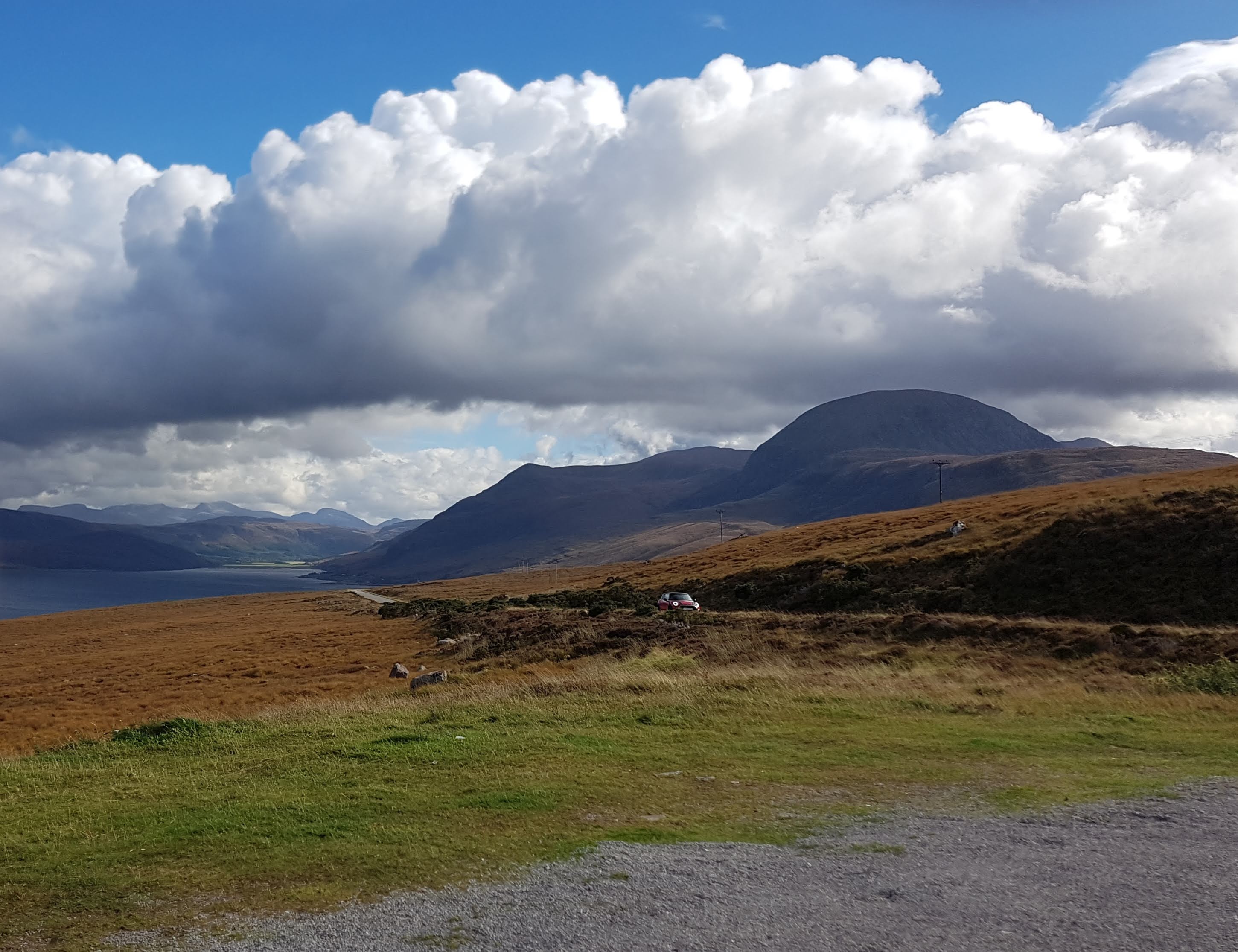 you come to a place called Gruinard and about a kilometer off the coast an island called