Campervan Adventures #4 North by Northwest

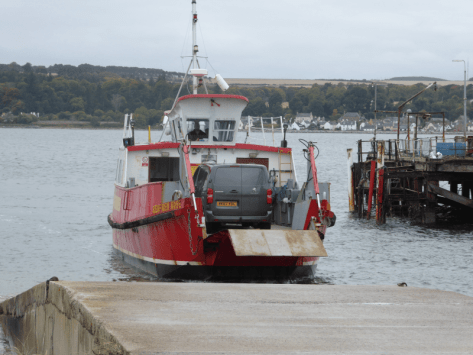
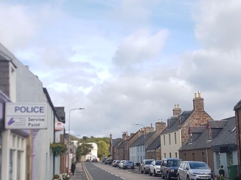
Once you are at John O’Groats you can go west or south*. Going south would have meant retracing my path, so west it was. Going west, the road runs along the north coast of Scotland, sometimest beside the Pentland Firth, but more often a mile or so inland. It passes through several villages and after about 25 miles comes to Thurso, which is (apart from Wick) the only town of any size in this part of the world. Perhaps it was the weather, it was a bit grey and fairly chilly when I arrived there, perhaps it was the fact that the town has a bit of a run down feel to it, but it did seem as if I had arrived at the “Ends of the Earth”

First impressions aren’t always completely accurate. Wandering round the town I found that it is quite a pleasant place (if a little run down) and it has a very interesting small museum/art gallery, Caithness Horizons. Which also has, as you would probably expect a rather good café attached. You can tell that it is good as soon as you enter, because it seems to be the place where, if she had lived in Thurso, my mum and her friends would have met for coffee, cake and a blether. There is no way that mum would have put up with inferior coffee or cakes. So after a look round the museum I had my lunch there.

Caithness from Annemarie Gibson on Vimeo.

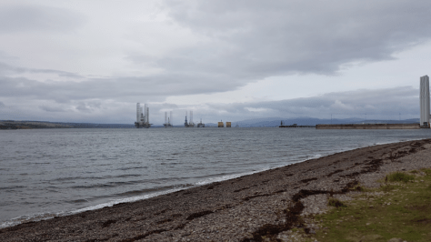
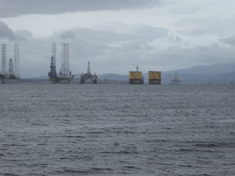
Moving on after lunch I carried on along the coast road to Dounreay . This was the site of an experimental semi-commercial nuclear reactor known as a Fast Breeder Reactor. (There is a good section in the museum on the history of Dounreay. It also has a reconstructed control room from one of the reactors.)
20180922_173616

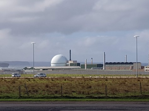
There was a reason that it was built in this remote part of Scotland. It wasn’t to bring jobs to a depressed area (although it did that to an extent). With most nuclear reactors if things go badly wrong you will have what is known as a meltdown, as happened at Three Mile Island, Chernobyl and Fukushima. Meltdowns are serious enough, but if things had gone seriously wrong at Dounreay a fully fledged nuclear explosion was possible. The last reactor was taken off-line in 1994 (though the Royal Navy continued to run a smaller reactor for nuclear submarine research until 2015). The plant is currently being decommissioned, a process that might be complete by about 2118, though it is thought that It will be about 300 years until the site is fully decontaminated.


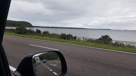
After Dounreay the roads became single track with passing places, even the roads designated as “A” roads. They continued as single track with a few exceptions for the next three days. Further along the coast I came to Farr Bay, near the village of Bettyhill. I stopped to make myself a cup of coffee, then the sun came out so I went for a walk along a pristine deserted beach.

Looking at the surf made me think that this is the real North Shore, who needs that one in Hawaii.

Continuing along the coast to Tounge I had a decision to make, whether to continue on to the North West corner, though it wouldn’t be possible to get to Cape Wrath except on foot, or to turn south. Because I had for some unaccountable reason always wanted to visit the village of Altnaharra I decided to turn south. It should be noted that villages in this part of Scotland are not like villages in the rest of the world. Houses tend to be spread out and a village is deemed to exist when the houses get a bit closer to each other.

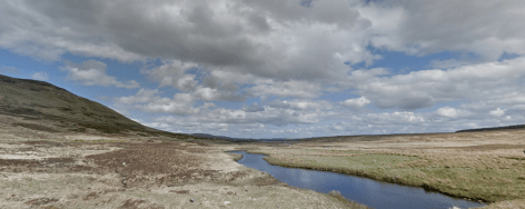
I set off south in the direction of Altnaharra and Lairg through an almost deserted, bleak but rather beautiful landscape of peat bogs, lochs, heather and hills.

Road to Altnaharra

Altnaharra came and went and to be honest I would have missed it if I hadn’t noticed a sign for the Altnaharra hotel. I thought about heading west again, but as I had decided that while I was in the remoter parts of the Highlands not to let the fuel tank get much lower than half full, and I was slightly below that, the best plan would be to carry on down Loch Shin to Lairg, where I was fairly sure that I would be able to find a petrol station. When I arrived there it was about 18:30 so I ended up spending the night there. There was also a hotel with a restaurant just at the entrance to the campsite, so I let someone else do the cooking and washing up tonight.

*Not strictly true, Duncansby Head is slightly further east and Dunnet Head is a bit further north, and of course, you can always get the ferry north to the Orkneys.

Campervan Adventures#3 To the Ends of the Earth

Storm ‘Ali’ had passed over and all was relatively quiet and peaceful. It was time to move on in search of places and adventures new. I had decided the night before that John O’Groats was the next destination. I set off with the intention of getting there by sometime in the late afternoon.
However…. Strangely enough I got distracted. By Inverness.

By the time I had driven up to Inverness it was about 11:30, my original plan was to bypass the town and carry on north over the Kessock Bridge. Then I thought Inverness would offer a greater choice of places to have lunch than some of the smaller towns and villages further north. So I might as well stop there for lunch and have a look round.

What did I have for lunch, I can’t remember, so probably a sandwich or similar. Then I went for a wander and found the River Ness, which is the river that flows out of Loch Ness to the sea. No sign of Nessie making a break for freedom though.

Inverness is a very attractive town (city? it has a cathedral), especially down by the river, as can be seen from the photos. As I was walking along the river I came across Inverness Cathedral. I quite like mooching around old churches (although dating from the mid c19th it’s not that old by European standards) so I decided to have a look around. What I found really made my day. There was a concert by the students of Sgoil Chiuil na Gaidhealtachd (translates as Music school for the Highlands). It is based at Plockton High School on the west coast. There were some seriously talented young traditional musicians on display. I loved the concert and bought their CD, which became the soundtrack for the rest of the trip.

Image result for brick by brick Sgoil Chiuil na Gaidhealtachd

If you would like to hear some of their music click on the picture of the CD above and it will take you to their Spotify page.

This left me about three or four hours behind schedule, not that it mattered, but it did mean that I wasn’t going to make John O’ Groats today.

I took the scenic route round the Beauly Firth and stopped for the night in Beauly.

20180920_1817584276547180557184190.jpg
The “Starlight Express” in Beauly

The next morning I was up bright and early, I discovered that the van had a built-in alarm clock, which you had to get out of bed to switch off. Which worked better than setting an alarm on my phone, that I could cancel while still in bed. The objective today was to make John O’ Groats.

Again I decided to take the scenic route following the coast rather than just hammering straight up the A9.

I decided to take a bit of a detour to take a look at Nigg Bay.

p1000698-e1539029186244.png
Cromarty to Nigg Ferry

If I had known that this ferry existed I would possibly have driven along to Cromarty to catch it

20180921_114342.jpg
Nigg Bay

Nigg Bay used to be the main centre for building and repairing the various rigs and other sub sea structures used in the Scottish North Sea oil fields. That still comprises a fair bit of the work carried out there, but construction of offshore wind turbines is becoming increasingly important.

P1000697.JPG
Nigg Bay

After my detour I found my way back to the A9 and followed it round the coast.

20180921_125332
The view from the A9

It eventually led me to Golspie in time for lunch. I found a coffee shop with the marvelous name of “The Coffee Bothy”.  They do a rather nice butternut squash and chilli soup as well as coffee (obviously) and sandwiches. A big bowl of soup and a sandwich was, if I remember correctly, £4.50.

20180921_134814.jpg
Golspie High Street

Standing above Golspie on the summit of Ben Bhraggie is a gigantic statue, known locally as “The Mannie”. It is of George Leveson-Gower, Marquis of Stafford and First Duke of Sutherland. He was a controversial figure, responsible for “The Clearances”. Some could interpret his actions as a those of a social reformer, others see him as a monster. The link above gives some information. The land was cleared of the subsistence farmers, who had lived there for generations to make way for massive sheep farms, stocked with Cheviot sheep, largely shepherded by Border shepherds. My 3x great-grandfather Francis Renwick appears to have been one of the shepherds who went North.

p10007031
The “Mannie”

After lunch, a walk round Golspie and some food shopping, it was onwards and upwards to John O’ Groats. I thought about stopping at Dunrobin Castle – the ancestral seat of the Dukes of Sutherland – which is a few miles north of Golspie, but decided against it.

As you carry on northwards towards Wick and John O’ Groats the landscape becomes increasingly bleak. It is fairly flat with peat bogs and almost no trees. But it is also comparatively high up. All along the coast there are high cliffs. Pressing on and avoiding the temptation to stop in Wick (not that much of a temptation) I arrived at John O’ Groats about four in the afternoon.

Trying to get a half decent selfie in front of the John O’ Groats sign proved slightly problematic. Trying to avoid being blown away whilst taking it was also a problem.

I was a bit upset by the state of the sign post. Applying a sticker to it (a bit like a dog peeing on a lamp-post) to mark the fact that you have been there appears to have become a thing. All I have to say to any one who reads this blog is don’t do it.

I decided to stay the night at John O Groats. There is a decent campsite. Although I couldn’t find anywhere for an evening meal. It wasn’t really a problem. I cooked up some pasta and opened a bottle of wine. Problem solved.


Now that I had reached the ends of the Earth, all I had to do was find my way back.